
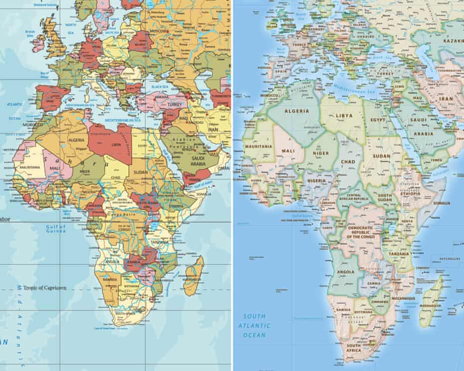
The United Nations General Assembly has voted to promote a new approach to world mapping that more accurately represents the relative size of continents, particularly Africa, which appears significantly smaller on the widely used Mercator projection.
On Friday, 4 September 2026, at UN headquarters in New York, the General Assembly adopted the “Correct the Map” resolution by a vote of 164 in favour to one against, with six abstentions. The United States was the only country to vote against the resolution, while Estonia, Georgia, Lithuania, Moldova, Serbia and Ukraine abstained.
The resolution was championed by Togo on behalf of the African Group and supported by the African Union. It calls for greater use and consideration of equal-area map projections that more accurately portray the relative sizes of the world’s regions, particularly Africa.
However, the resolution does not ban the Mercator projection or make the Equal Earth projection mandatory. It is non-binding and instead encourages governments, educational institutions, international organisations, publishers and digital platforms to consider more geographically accurate projections where the relative size of landmasses is important.
The issue has attracted particular attention in Africa because of the way the Mercator projection distorts the apparent size of countries and continents. Greenland, for example, can appear comparable in size to Africa on a Mercator map, although Africa is actually about 14 times larger than Greenland.
“Maps shape our understanding of the world,” the UN quoted Togo’s Foreign Minister, Robert Dussey, as saying before the vote. “They guide education, nourish the imagination, and influence collective perceptions.”
“It’s time for us in Africa to take responsibility to change what we can change ourselves.”
The Mercator projection was created in 1569 by Flemish cartographer Gerardus Mercator, primarily for maritime navigation. It preserves directions and angles, making it useful for navigation, but it significantly distorts the size of landmasses as they become farther from the Equator.
As a result, regions near the poles appear much larger than they actually are, while areas closer to the Equator, including Africa, appear comparatively smaller. The distortion is a consequence of transferring the curved surface of the Earth onto a flat map.
The Equal Earth projection, developed in 2018 by cartographers Tom Patterson, Bojan Šavrič and Bernhard Jenny, is an equal-area projection designed to preserve the relative sizes of landmasses.
Kioko Muendo, a Kenyan geographer, said the way Africa is represented on conventional maps can influence perceptions of the continent’s scale, resources, population and investment potential.
“Maps are more than just guides for travellers — they shape how regions are perceived politically and economically,” Muendo said.
The UN resolution marks a significant push for more accurate and representative cartographic practices, particularly in education and public communication. However, the Mercator projection will continue to have legitimate uses, especially in navigation, where its preservation of angles and directions remains valuable.
The vote therefore does not mean that the world has officially abandoned the Mercator map. Instead, it represents a call for greater use of projections that show the world’s landmasses in their true relative proportions.